
Ireland’s walking days come in many forms: a slow circuit through mature trees, a reservoir path near the city, or a longer climb with the coast spread out below. Autumn colour and changing light can make familiar places feel fresh, but a good day out begins with choosing a walk that suits the forecast.
These 15 ideas span parks, woods, mountains and coastal paths across the island. They are grouped by setting so you can find an outing that fits your trip, then use the linked route information to check the details. This is a planning guide, not a substitute for a trail map or navigation.
Woodland, gardens and waterside walks
Start here if you want to plan a park or forest outing. These places still need suitable conditions: trees are not shelter during dangerous winds, and wet paths can be slippery.
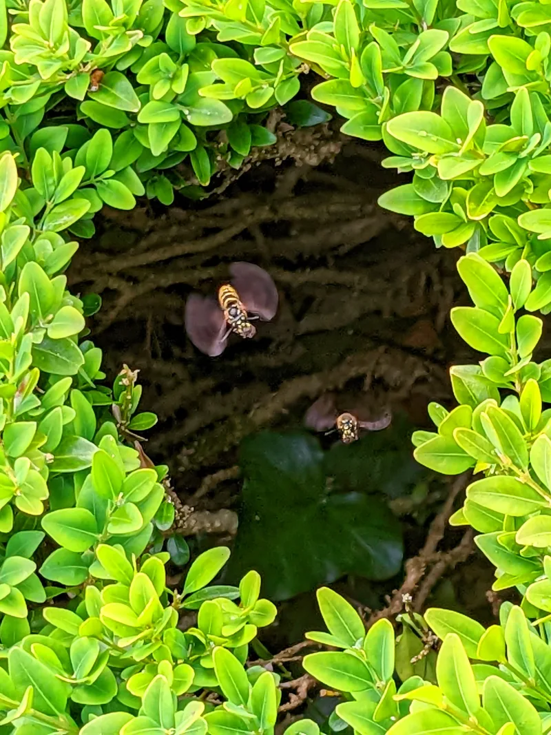
Dublin · A park visit on Dublin’s southern edge
1. Fernhill Park & Gardens
At Stepaside, Fernhill combines the grounds of a former estate with woodland and gardens above Dublin Bay. The pleasure here is in slowing down: take in the planted areas, look at the mature trees and make a short outing of the park itself. It is a useful place to consider when you want time outdoors without committing to an open mountain route.
Plan it: Check the council’s seasonal gate times and park rules before travelling; access arrangements differ across the grounds.
- Type
- Park and garden paths
- Access
- Seasonal gate times
Access & map notes
Check the council’s current opening information. No official downloadable walking map was verified.
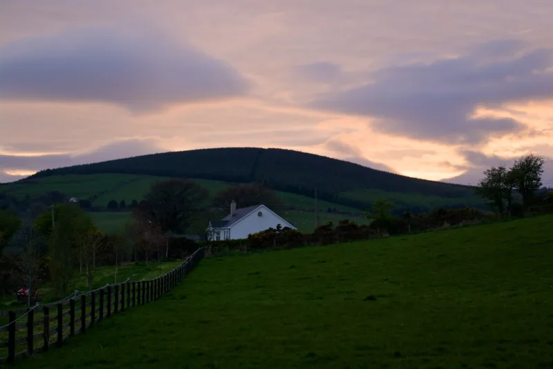
Wexford · A choice of woodland trails near Coolgreany
2. Ballyfad Wood
Ballyfad is a good reminder that a memorable walking day need not involve a summit. Coillte’s trail network passes through mature woodland, with oak, beech and conifers giving the landscape variety. Choose your route at the trailhead rather than following the first path you see. The shorter Beech Trail and longer Ballyfad Trail offer different ways to fit a walk around the rest of a Wexford day.
Plan it: The Beech Trail is listed at 1.5km and the Ballyfad Trail at 5km. Use the trail map to match the distance and grade to your group.
- Beech
- 1.5 km · 45 min · Easy
- Bluebell
- 3 km · 1 hr 20 min · Moderate
- Old Mass Path
- 4.3 km · 1 hr 35 min · Easy
- Ballyfad
- 5 km · 1 hr 50 min · Easy
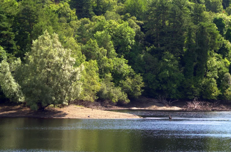
Dublin · Water and woodland in Glenasmole
3. Bohernabreena Reservoirs
The reservoir paths bring a different side of Dublin into view. In Glenasmole, the Upper Reservoir Loop follows the valley and continues around the upper reservoir, with trees and waterworks adding interest along the way. Make this a walk to enjoy at an unhurried pace, rather than treating the water as a backdrop for a quick photograph. It also pairs naturally with a wider Dublin Mountains visit.
Plan it: These are working water-supply reservoirs. Follow the designated route and local access instructions, and plan your return before the gates close.
- Distance
- 8.5 km loop
- Grade
- Easy
- Waymarks
- Orange
- Toilets
- None on site
Access & map notes
Allow a pace-appropriate time for the full 8.5 km; the publisher’s 60–90 minute estimate should not be treated as a comfortable pace for every group.
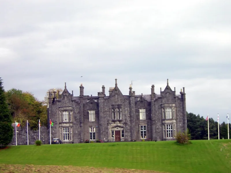
Mayo · A riverside woodland stop near Ballina
4. Belleek Woods
Belleek brings woodland walking close to Ballina, with views towards the River Moy and its estuary. Sport Ireland identifies a multi-access trail on forest road and track through the mixed woodland. That makes it a useful route to investigate for a shorter outing, while the wider woods offer further possibilities. Choose a specific signed trail so that everyone knows the intended distance and return point.
Plan it: A multi-access designation applies to the named trail, not every path in the woods. Check current surface conditions and individual accessibility needs.
- Forest loop
- 4 km · 1 hour · Easy
- Multi-access trail
- 1.7 km
Access & map notes
The multi-access designation applies to the named trail, not every woodland path.
Wicklow · Forest, poetry and the River Vartry
5. The Devil’s Glen
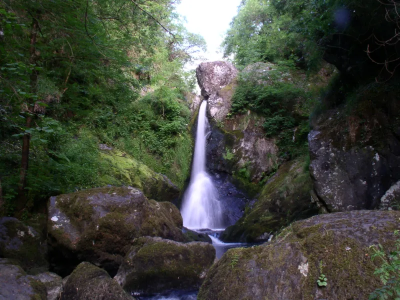
Near Ashford, the Devil’s Glen has two distinct reasons to linger: the wooded setting of the Seamus Heaney Walk and the waterfall reached by the Waterfall Walk. The river runs through a gorge, giving the place a stronger sense of drama than a simple forest stroll. Coillte lists both waymarked loops as moderate, so allow time for the terrain rather than judging the outing by distance alone.
Plan it: The Seamus Heaney Walk is 4km and the Waterfall Walk 5km. Some sections have steep, exposed slopes; check the automatic gate’s closing time.
- Seamus Heaney Walk
- 4 km · 2 hours · Moderate
- Waterfall Walk
- 5 km · 2 hours · Moderate
Access & map notes
Some slopes are steep and exposed. Check seasonal automatic-gate closing times.
Hill walks and bigger viewpoints
These choices need more planning. Pick the actual route before you travel, check its grade and allow for the slower pace of the least experienced person in your group.
Dublin · A hill walk overlooking the capital
6. Fairy Castle Loop, Ticknock
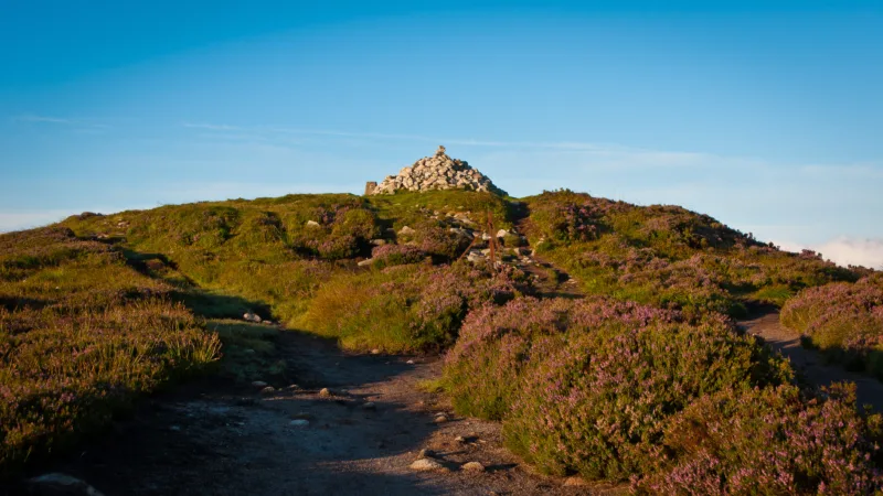
Ticknock links forest tracks with the more open ground around Three Rock and Fairy Castle on Two Rock Mountain. The contrast is the attraction: Dublin and the bay can feel close below you, while the upland landscape stretches away in the other direction. Coillte lists the Fairy Castle Loop as a 5.5km moderate route. Pick a day with clear visibility if the views are your main reason for going.
Plan it: Follow walking waymarks, respect any forestry diversions and stay off dedicated mountain-bike trails. Check Dublin Mountains Partnership notices for current works.
- Distance
- 5.5 km (Coillte)
- Time
- About 1½ hours
- Grade
- Moderate
Access & map notes
Use walking waymarks and current diversions; dedicated mountain-bike trails are separate.
Wicklow · An exposed mountain day for experienced walkers
7. Djouce
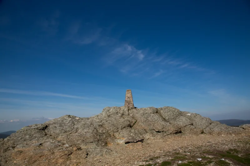
Djouce’s 725-metre summit is a substantial step up from a park or woodland loop. Wicklow County Tourism describes its suggested summit routes as strenuous and suitable for fit, experienced walkers. The summit is a steep diversion from the Wicklow Way, rather than a fully waymarked continuation of it. Plan the exact approach, carry navigation equipment and leave the summit for another day if visibility or wind makes the outing unsuitable.
Plan it: Do not assume the whole route is a boardwalk. The summit trails are unmarked and exposed, and distances vary with the starting point.
- Lough Tay
- 7.4 km · 2½ hours
- Ballinastoe car park
- 12.3 km · 4 hours
- Djouce Woods lake car park
- 10.7 km · 3 hours
Access & map notes
GPS tracks support planning; take a mountain map and compass and know how to use them.
Fermanagh · Blanket bog and a steep staircase
8. Cuilcagh Boardwalk Trail
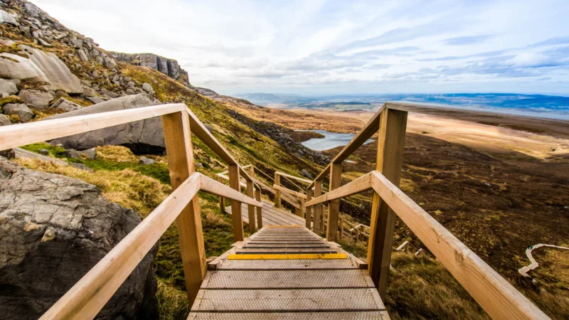
Cuilcagh’s boardwalk crosses a landscape worth noticing long before the famous steps begin. The route combines a farmland track, protected blanket bog and a steep ascent to a viewing platform. The Geopark grades it difficult; the presence of timber underfoot does not make it an easy promenade. Keep to the designated trail, and make the platform your turning point in line with the operator’s current advice.
Plan it: Check current closures and parking arrangements. Dogs are not permitted, and access beyond the viewing platform to the summit is currently not recommended.
- Grade
- Difficult
- Terrain
- Track, boardwalk and stairs
- Dogs
- Not permitted
Access & map notes
Turn at the viewing platform. The Geopark currently advises against continuing to the summit. The PDF is approximately 17 MB.
Sligo · A hilltop with an ancient story
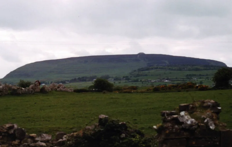
9. Knocknarea
The great cairn associated with Queen Medb gives Knocknarea a distinctive purpose as well as a fine setting. This is a place to combine a hill walk with an appreciation of Sligo’s passage-tomb landscape. Choose an established approach and allow time to pause near the monument. The story attached to the cairn is part of the experience, but the monument itself deserves the same care as any protected archaeological site.
Plan it: Do not climb the cairn or move its stones. Review the Queen Maeve Trail information and choose a route appropriate to your fitness and the conditions.
- Distance
- 6.5 km loop
- Time
- 2½ hours
- Grade
- Strenuous
- Dogs
- Not permitted
Access & map notes
Keep off the summit cairn and leave its stones in place.
Donegal · Choose the viewpoint outing or a mountain route
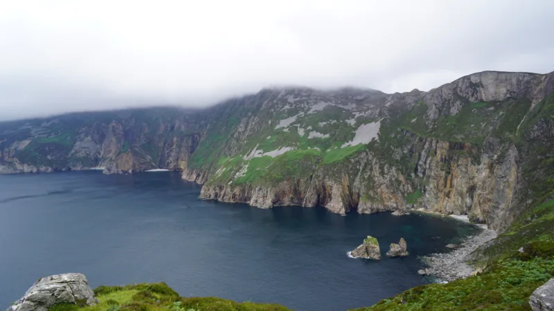
10. Sliabh Liag
At Sliabh Liag, first decide what kind of day you want. The approach to the main Bunglas viewing area offers a way to appreciate the cliffs without committing to a long mountain traverse. Longer upland routes are a separate undertaking, with different demands on experience, navigation and weather. Give the scenery time, and let your group’s ability determine the plan rather than trying to add every viewpoint to one visit.
Plan it: Check current visitor access and transport arrangements. This guide does not recommend One Man’s Pass as a casual walking extension.
- Route choice
- Viewpoints or mountain hike
Access & map notes
Confirm current access and shuttle arrangements with the visitor centre. No downloadable map for this exact viewpoint outing was verified.
Coastal walks for a suitable weather window
The sea is the attraction, but exposure is part of the route. Save headlands and cliff paths for conditions that allow a comfortable, well-planned walk.
Sligo · A coastal outing with broad bay views
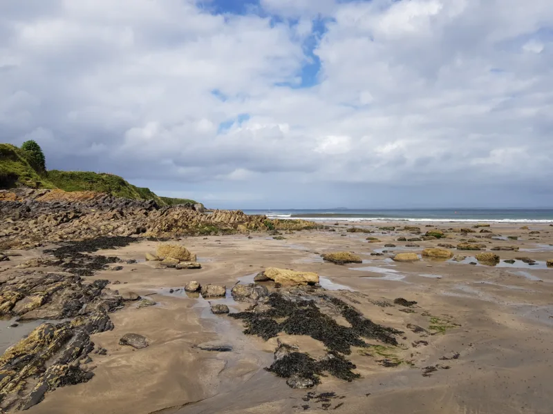
11. Aughris Head
Aughris offers the chance to connect a headland walk with the beaches of Aughris and Dunmoran. The setting takes in Sligo Bay and Knocknarea, making it a rewarding stop on a coastal itinerary when the weather allows. Choose the signed coastal route for a headland walk, or make a separate, shorter beach visit. They are different outings, so plan the access and return for the one you actually intend to do.
Plan it: Keep well back from cliff edges and follow local signs. An exposed headland is a poor choice in strong winds or low visibility.
- Grade
- Moderate
- Time
- About 1½ hours
- Dogs
- Not permitted
Access & map notes
Published length estimates vary. Match the current trailhead route to the map and stay clear of exposed cliff edges.
Mayo · Atlantic scenery on the Mullet Peninsula
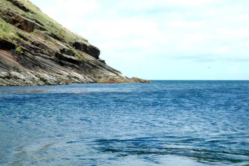
12. Ceann Iorrais / Erris Head
Erris Head is a place to read the coast as well as admire it. Look for the wartime ÉIRE marking and the offshore rock formations described in the official route information. The headland’s open character is central to its appeal, but it also means there is little separation between you and Atlantic weather. Choose the loop only when the forecast and ground conditions suit an exposed coastal walk.
Plan it: Use the marked route and designated viewing point. Follow livestock and access notices, and give cliff edges a generous margin.
- Registered distance
- 3.9 km loop
- Time
- 2 hours
- Grade
- Easy
- Dogs
- Not permitted
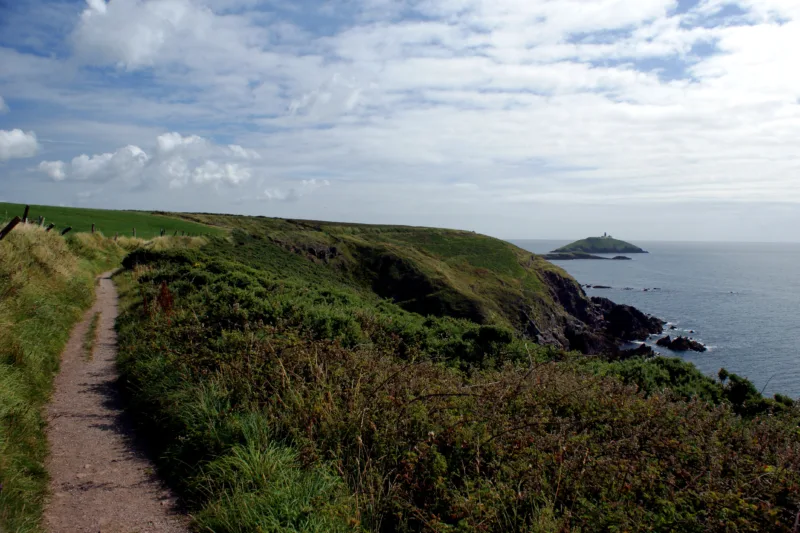
Cork · A village-to-coast walk in East Cork
13. Ballycotton Cliff Walk
Ballycotton’s coastal path leads from the village towards Ballyandreen, with farmland on one side and the sea on the other. It is an appealing way to build some walking into an East Cork visit without making the day solely about a mountain summit. Decide your turning point before setting out: a linear route still needs time and energy for the walk back, even when the outward views keep drawing you on.
Plan it: Confirm local access and trail notices before setting out. Wear footwear with grip and avoid the exposed cliff path in unsuitable weather.
- Coastal return
- About 7 km
- Road-return circuit
- About 9.25 km
Access & map notes
No official downloadable trail map for this exact outing was verified.
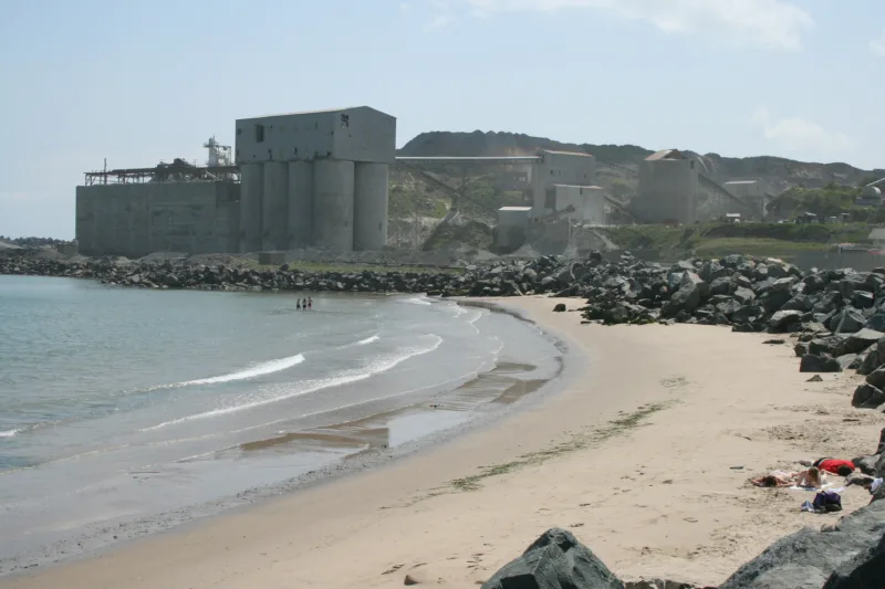
Wicklow · Coastal views beside a working landscape
14. Arklow Rock
Arklow Rock’s trail offers views along the coast, with Wexford to the south and the Wicklow Mountains to the north. Visit Arklow describes an initial steep climb followed by an undulating gravel route. Its position beside an active quarry is an important part of planning a visit: this is a designated recreational path beside a working site, not permission to explore the quarry or take an improvised shortcut.
Plan it: The local guide describes about 5km out and back. Confirm current access, obey all gates and signs, and keep clear of operational areas.
- Distance
- About 5 km out and back
- Start
- The Cove car park
Access & map notes
Obey gates and operational signs. No official downloadable route map was verified.
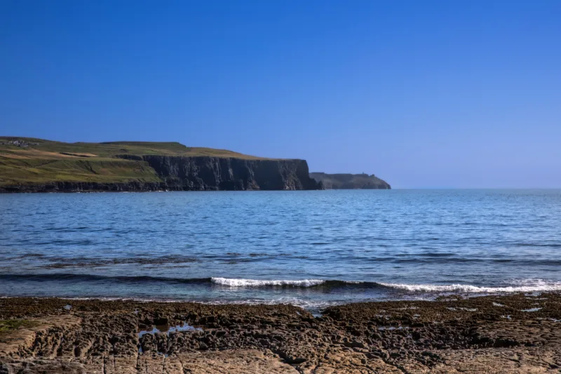
Clare · Plan around the coastal-path closures
15. Cliffs of Moher: designated visitor walkways
The Cliffs of Moher belong on a scenery shortlist, but the full coastal walk is not currently an available through-route. The operator’s notice closes the southern Liscannor/Hag’s Head section and limits the Doolin section to Surfers Path, with no onward access to the visitor experience. For a visit centred on the cliffs, use the designated walkways and viewing platforms within the Cliffs of Moher Experience, subject to its opening and weather arrangements.
Plan it: Access checked 15 October 2026. Recheck the official closure notice before travelling; do not cross barriers or plan a Doolin-to-visitor-centre walk.
- Southern coastal section
- Closed
- Doolin section
- To Surfers Path only
Access & map notes
No onward access to the visitor experience from Doolin. Do not use older through-route maps to bypass closures.
Before you go: make the day work for your group
Check the route, not just the place name. A forest can contain several trails with different grades, while a famous viewpoint may sit beside a much more demanding mountain route. Confirm the starting point, total distance, ascent and return journey from the trail operator’s map.
Work backwards from daylight. Leave room for breaks, slower sections and the return to your car or bus. Bring a charged phone, suitable navigation, water, food, waterproof layers and footwear that suits the ground. For an upland walk, tell someone your route and expected return time.
Check access for everyone coming. Do not assume that a route is suitable for a buggy, wheelchair or dog because one section looks level. Confirm the specific trail’s rules, gates, steps and current surface conditions. Never leave litter, disturb livestock or widen a muddy path by walking through sensitive vegetation.
Keep a flexible alternative. If the planned coast or summit is unsuitable, choose a lower-level route only if it is also open and appropriate for the conditions. A museum, town visit or indoor stop can be the better choice during severe weather.
Build the walk into a wider Ireland trip
For more ideas, browse our hiking collection, cliff-walk collection and county travel guides. A walk can be the centrepiece of a day, or one well-chosen stop between a town, a heritage visit and somewhere to eat.
Plan an island outing
If an island visit is part of your walking trip, plan the crossing separately from the walk. These guides cover departure points, access and return arrangements; check the operator and conditions before travelling.